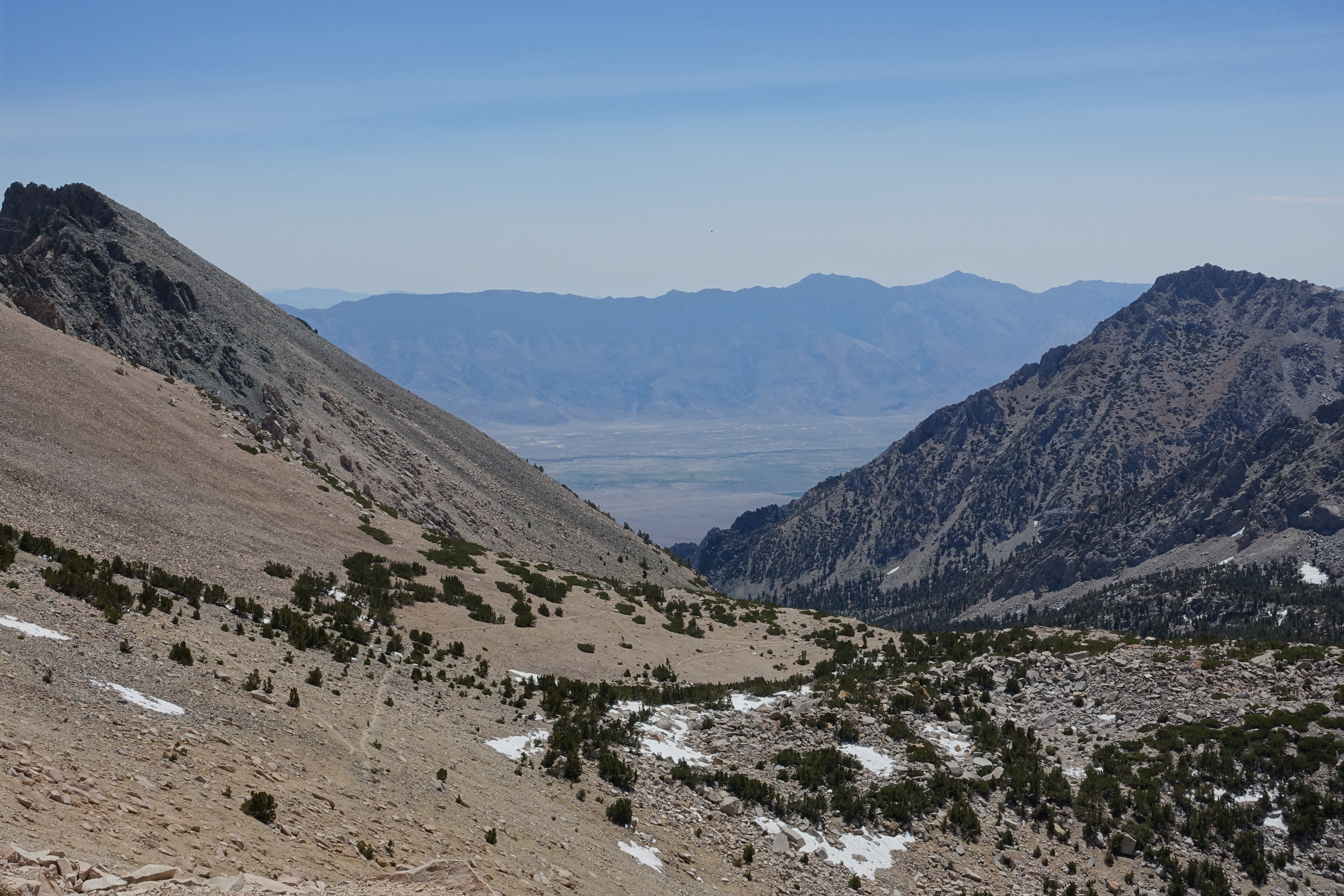
Today, we were going to head into town via a long side trail, which goes by Bullfrog Lake, up and over Kearsarge Pass, and ends at the Onion Valley Trailhead. There aren’t a lot of choices for resupply in the Sierras, so going off trail for 8 miles each way was an acceptable detour. The objective was to hitch a ride from the trailhead to the small town of Independence, CA, on highway 395.
Last night had been warm, so we were able to comfortably get going early. Almost immediately, the trail became steep. After a few miles, we reached the Bullfrog Lake trail junction, where we left the PCT to head towards Kearsarge Pass. The trail became even steeper here. I’ve heard that the PCT has a policy of staying under 20% grade whenever possible. This trail was definitely not part of the PCT.
I suspect I’ll be saying this a lot throughout the Sierras, but the trail passed idyllic lakes and meadows, and then had a steep climb to a rocky pass. Then, on the way down, more idyllic lakes and meadows, plus some waterfalls.
Down at the bottom of the trail, the parking lot was nearly full, even though it was the middle of a Tuesday. We got a ride just about instantly, with a father who had just dropped his daughter off on the trail (trail name Green Bean).
He drove us down to the small town of Independence where we had decided to resupply. This was a mistake. There was only a gas station for food, and it wasn’t a good source for backpack-able food. I’ll be eating a lot of trail mix and Hostess pastries for several days. There weren’t even any prices on the shelves, so it was impossible to judge value. I wanted to hitch into Bishop for new shoes and better resupply and lodging, but Elizabeth was worried about getting a ride, so we stayed in Independence.
We had lunch at the Independence co-op’s deli counter. Like the town as a whole, it was lethargic and eerily vacant. But, their pizza was tasty, and the salad hit the spot after days of pop tarts and top ramen. They had some kind of lime coconut mint iced drink that combated the hundred degree weather and my probable vitamin deficiencies admirably.
We checked into the Independence Inn, the cheapest motel in town that had vacancy. It attracted guests by having a giant road sign bearing their logo. Their logo was just the American flag.
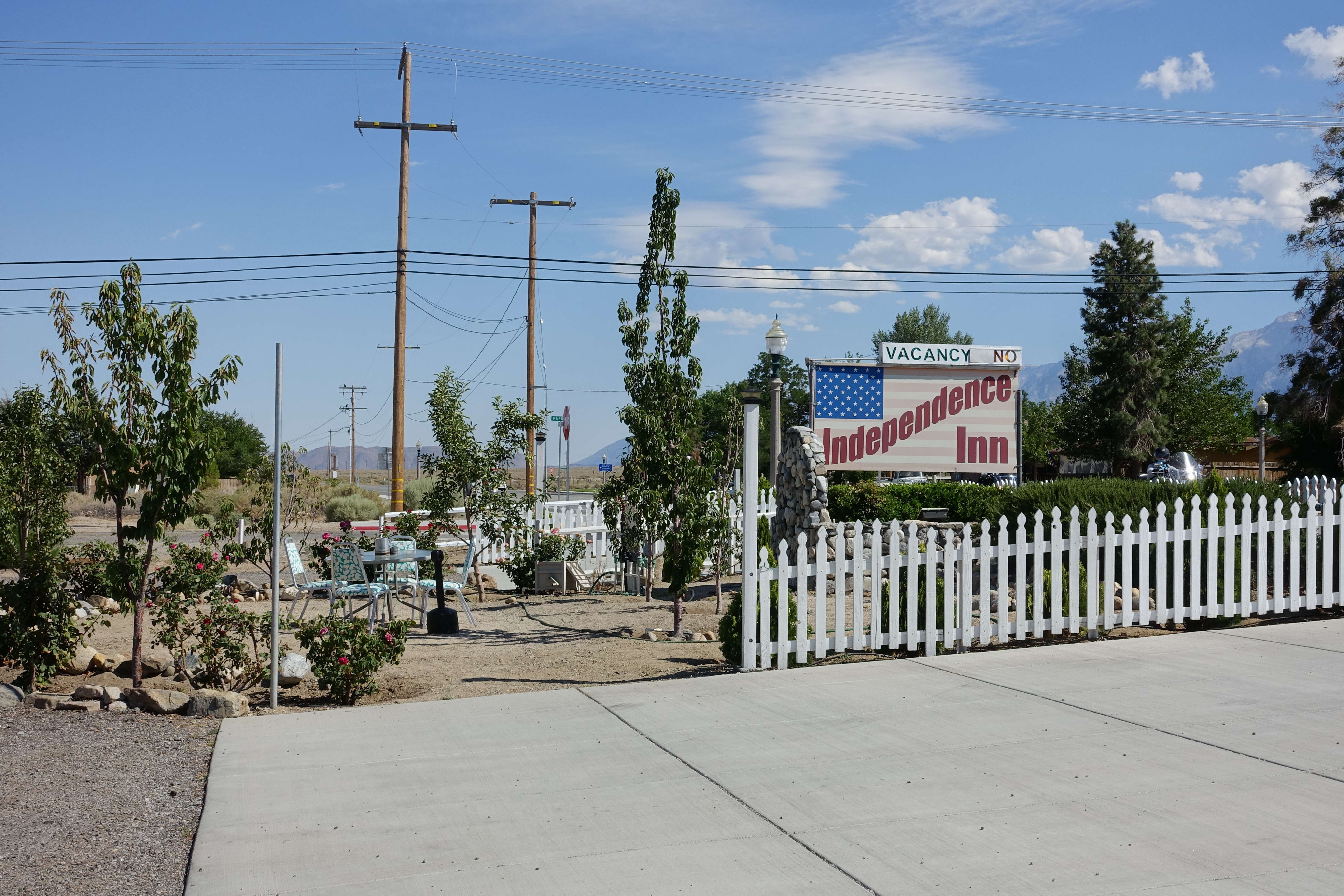
The owner, Jim, was very talkative — as I did laundry, for example, he told me about the supremacy of American top-loading washing machines to those suspect, European front-loaders. He explained that the gas station resupply was so bad because the owner was Pakistani. As we left the motel for dinner, I heard him shouting at a Japanese guest, in hopes that the increased volume would help him understand English better.
Aside from the co-op, which was lunch-only, there were only two restaurants in town: The Still Life Cafe, which was quite expensive, and Subway. We opted for the later, and had cheap calories with unlimited soda refills.
After dinner, we had a standard PCT trail town evening: More Mammoth beer, a pint of Ben and Jerry’s Milk and Cookies ice cream, and TV shows that told us about bear attacks (in living rooms, even), people of unusual sizes, and so on.